By the mid 1800s, in some areas of the country, middle class housing developments of detached houses standing in their own grounds were forming the basis for the idea of garden cities – combining the best of town and country.
Nationally, these ideas were given added impetus by Ebenezer Howard (1850–1928) in his now famous book Tomorrow: A Peaceful Path to Reform published in 1898. It laid the foundations for garden cities and garden suburbs that would become popular in the early 20th century, the first of these being Letchworth in Hertfordshire, built among green fields in 1903.
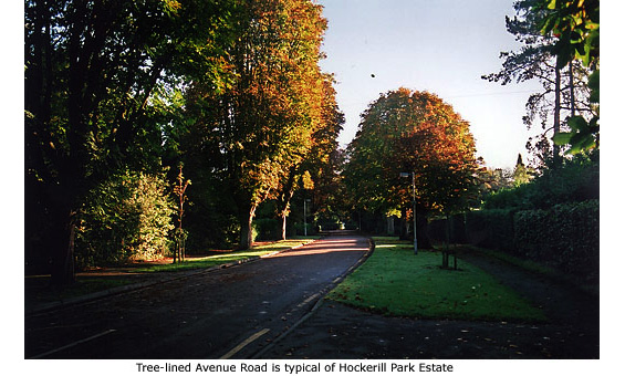
But in Bishop's Stortford, Walter Gilbey was seemingly ahead of the game. Included in his purchase of the Manor of Stortford from the Ecclesiastical Commissioners in 1868, was approximately 950 acres of land east of the river Stort known as the Bishops Park, and on a part of it, long before publication of Howard's book, he began to create Hockerill Park Estate. Developed with wide roads, avenues of trees, grass verges and easy access to the town’s railway station, it was the perfect 'garden suburb'. The only thing missing was houses.
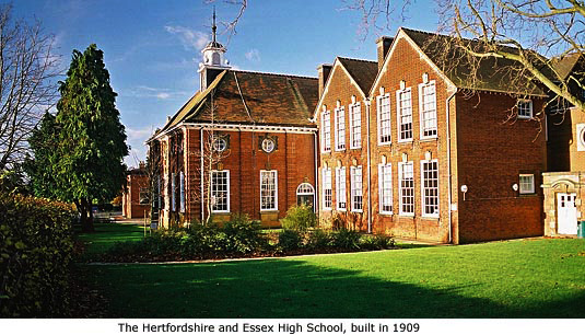
Gilbey did build and own No 14 Warwick Road (though he never lived in it) and a school was erected in 1909 (see below). But not until after Gilbey's death in 1915 did any large scale development take place, and only then were previously un-named roads given titles: Crescent Road, Avenue Road, Pine Grove and Thorn Grove. A later thoroughfare constructed between Avenue Road and Pine Grove was named Gilbey Avenue in memory of the estate's founder.
*The most notable person to live in Warwick Road around this time was the renowned Hertfordshire antiquarian *William Blyth Gerish (1864 –1921), who lived at Ivy Lodge
The road which was to become Warwick Road (named after the Countess of Warwick) is shown in the Enclosure Award of 1826, which was made pursuant to an Enclosure Act of 1820. But at that time the road, described as 'right of way 15ft wide' stretched only from London Road as far as the lane that leads to No 26 Warwick Road.
The land immediately to the east of this lane was auctioned in 1877, though the site of the former Fox Brewery in Dunmow Road (currently a car sales business at the corner of Warwick Road) was owned by William Gee. According to the Herts and Essex Observer of 22 December 1877, Lot 1 was bought by Mr Gee at the auction sale, thus consolidating his land holding. The sales particulars of Lot 1 were:
A right of way 15 feet wide over a portion of the West end of this lot, as shown on the plan extending in a southerly direction, from the private road to the cottages, gardens and land adjoining, is reserved to the owner thereof.’ This is evidence that Warwick Road was regarded as a private road in 1877.
The OS map of 1879 shows the land unchanged but the eastern section of Warwick Road, which in effect was private property, was laid out after this date. Sir Walter Gilbey began laying out Hockerill Park, including the western end of the road in 1890.
In June 1895, William Gee proposed to sell part of his land at auction, which was described as:
'10 plots of valuable freehold building ground. Immediate possession (free from Tithe and Land Tax) admirably situate adjoining the Hockerill Park estate with good frontages to the Warwick road.’
At the auction sale, two plots were sold, two declared unsold and the rest were withdrawn. This is the earliest reference to the name Warwick Road and does suggest that Mr Gee had established a road on his mainly undeveloped land to service the few new properties there. For some time thereafter, the only property in this area was the Fox Brewery which had an address on and access to the Dunmow Road.
In 1902, the estate of William Gee (b.1830–d.1901) sold two parcels of land to Sir Walter Gilbey covering most of the northern side of Warwick Road, from the eastern boundary of the school site to the gate at the top of Warwick Road.
Though it was previously thought that Sir Walter Gilbey sold land for the building of Herts and Essex school, it was in fact William Gee's widow who sold the parcel of land (adjoining Gilbey's newly acquired land on the north side of Warwick Road) to the County Council on which to build the school in 1909/10.
That the road remained private is revealed in 1902 conveyances grants to the purchaser:
‘Together with so far as the Tr'ees have power to grant the same a right of way for all purposes connected with any of the said premises over and along the roads bounding the same.’
The same grants were purchased back by Hubert Spencer Gee into Gee family ownership in 1920 with the same rights of way conveyed back to him.
The OS map published in 1898 also provides the basis for 1910 Land Tax map. The 1898 map confirms that by then Warwick Road (though not named on the map) had been extended to Haymeads Lane – i.e. prior to 1902 when Mr Gee’s executors granted a right of way over it to Sir Walter Gilbey. The 1898 map also shows that a barrier existed at the eastern end of Warwick Road, no doubt to prevent trespass on to Mr Gee’s as yet undeveloped property, between the road and Haymeads Lane.
Present information (2010) is that Warwick Road is a private road in the ownership of a third party, mainly but not exclusively the Gilbey Trust, with the cost of its maintenance being borne by frontagers. The fact that the Gilbey Trust still pays the maintenance levy on behalf of frontagers for a number of properties in the road would seem to reinforce this conclusion.
Warwick Road also forms the estate's northern entrance opposite the railway station, the terrace of Victorian houses at its start being built in 1878 and very likely here before Gilbey's plan was implemented.
Information regarding the Enclosure Act, land ownership and the status of Warwick Road is thanks to Marie and John Rhodes
*William Blyth Gerish (pronounced Gearish) was born in Norfolk and educated at Great Yarmouth College. He then entered the service of the London & Provincial Bank and soon after moved to the bank's Chesthunt branch in Hertfordshire. From there he transferred to Hoddesdon and then to the Bishop's Stortford branch. From early on his hobby had been the study of antiquarian matters and after moving to Hertfordshire his life's work was in connection with the county. In 1898 he was instrumental in founding the East Herts Archaelogical Society (EHAS), of which he became Hon. Secretary.
When he learned, in 1907, that the Suffolk Archaeological Society were starting a scheme to record Monumental Inscriptions in the churchyards there, he started his own similar scheme in Hertfordshire under the aegis of the EHAS . Assisted by a small group of helpers all of Hertfordshire's monuments were recorded within six years, the first county to complete the task. The manuscript filled 13 large quarto volumes, comprising 8,000 pages containing some 70,000 entries, but unfortunately Gerish had overlooked one important point. The transcriptions contained no maps or reference points as to where any particular inscription was located. All the volumes are preserved at the British Library.
Poor health finally forced William Blyth Gerish to resign his post in London and in 1915 he left the county to live in Caister, Norfolk, where he died 12 March 1921, aged 56 years.


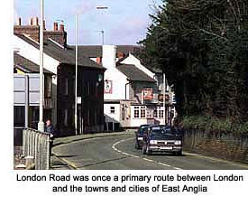
 Before Bishop’s Stortford’s first bypass opened in 1670 between Southmill and Hockerill, the section of road between Hockerill crossroads and today’s railway bridge was called the Hallingbury Road. That road now begins beyond the bridge, the modern offices of the local Tax office standing on the former site of Southmill Farm.